I was just wondering how people find out how far they are running. Marked trails, tracks, drive the route, pedometer, gps??
Loading...
I use the Timex Speed and Distance system. I bought mine before they added HRM functions. It uplinks to a satellite, so it's not the most effective for trail running or areas with lots of tall buildings. Works great for my purposes. Before that, I would pre-measure routes in my car. If I didn't have the Timex setup, I could use the computer on my road bike.
[edited for comma abuse]
Loading...
Forgot to bring up: the main reason that I love my (passive?) GPS system...spontaneity!
Loading...
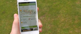
GPS now.
I used to drive courses and also had a list of point to points of different major streets so I could "make" new courses and know the distance.
I used to drive courses and also had a list of point to points of different major streets so I could "make" new courses and know the distance.
Loading...
I started out using my truck to drive off the distances. I graduated to using my bike but now I'm currently using a GPS which works great when you don't feel like running the same old routes.
Loading...
Another vote for the GPS.
On some of the forest preserve (county park) trails I run, there are mile-post columns. Also, a couple places I run are parallel and close enough to the commuter rail lines that you can pick up their markers every quarter-mile (and the boxes controlling gate crossing are often marked down to the hundreth-mile).
On some of the forest preserve (county park) trails I run, there are mile-post columns. Also, a couple places I run are parallel and close enough to the commuter rail lines that you can pick up their markers every quarter-mile (and the boxes controlling gate crossing are often marked down to the hundreth-mile).
Loading...
:1: Get in the car, and drive. Which reminds me...I got to find me some more trails to run. It's nice running over the River and all, but living exclusively on out and back courses is beginning to wear thin.I use my car's odometer.:1:
Loading...
I'm a gps junkie now too, but I also use Microsoft's Streets & Trips. It has a handy measuring tool where you drag the cursor down the street on a map and it adds up the mileage. Great for planning a new loop or figuring a course that will add up to an exact planned mileage. And even here in the ruralest reaches, every road is in there..it's amazin'.
Loading...
:1:
I don't have a river, but i only have out and backs and i'm typically lazy and don't measure new ones.
I don't have a river, but i only have out and backs and i'm typically lazy and don't measure new ones.
Loading...


